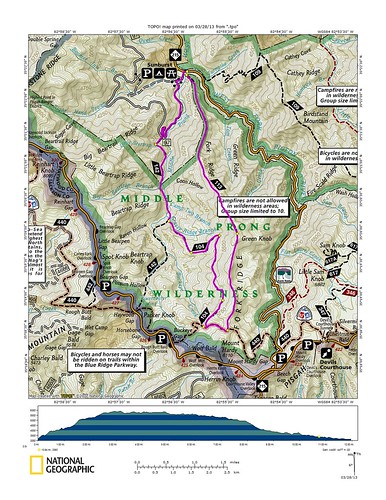
Our route was to be up Green Mtn. trail and then down Buckeye Gap trail to Haywood Gap trail:
Springtime has come to mountains and brought with it a steady cold rain as we started up Green Mtn. out of Sunburst. Gaining almost three thousand vertical feet in just over three miles, the start of Green Mtn. is the steepest climb you will find on any designated trail in the forest. The initial grade is quite simply absurd. It pushes the limits of what can really be considered running and breaks every rule of contemporary trail design but it is everything it should be and I love it. Ten minutes into our ascent I realized I had left my piece of the map down in the truck. A quick check of my altimeter showed we had already gained almost five hundred vertical feet so there would be no going down for the map. I know the trails, had my watch with a calibrated altimeter and compass, and simply did not need a map. At least that is what I told myself.
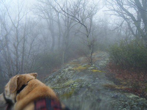

Green Mtn. was fantastic. The climb was relentless and was augmented by freezing rain and howling winds on a trail that was overgrown, covered in dead fall and carpeted by a layer of slippery leaves that covered treacherous rocks and roots. We surrendered to the flow of the trail and ran when we could, walked when it was called for and crawled when we had to. Green Mtn. is a very diverse trail that took us through several different ecosystems. As we approached the top of Green Knob we left the rhododendron behind and entered a high Spruce Fir forest and then as we ran across the knob we entered high grassy balds that the Black Balsam area are famous for. These brief balds led us back into a mixed forest where we found the Mountains to Sea trail right where we expected it. By this time the freezing rain had stopped but a heavy fog had moved in and reduced visibility to just a few feet. I paused at the trail intersection briefly as we considered heading up to the top of Mt. Hardy. With no map and heavy fog we opted to skip the easy trip up Mt. Hardy and went off looking for Buckeye Gap trail instead.

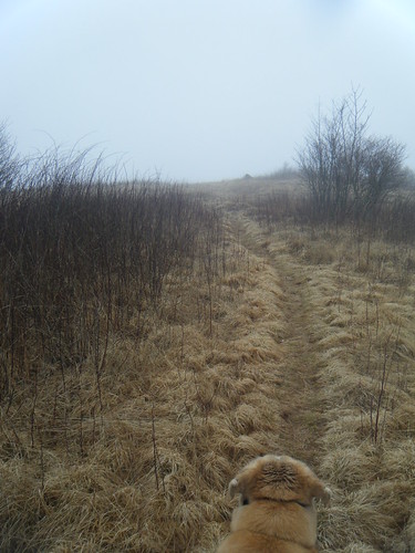
It was at that point that things got interesting and the Middle Prong showed her more sinister side. The Mountains to Sea trail is well maintained, heavily traveled and well marked everywhere except in the Middle Prong. No worries, Duma and I have been up there enough to know the turns. So we headed towards Buckeye Gap, found the trail right where we expected it and headed down. From previous trips I recalled a series of high mountain meadows near the top, one of which had an abandoned game cart in it. If we found that game cart I would know for certain we were on Buckeye Gap, but if we didn't find that game cart I also knew that didn't mean we were not on Buckeye Gap as the cart could have been removed. We didn't see the cart but everything else seemed right so we continued on and then suddenly we were back on the Mountains to Sea again after somehow circling around on ourselves. Uh, oh, but no big deal. We retraced our steps back out to another trail intersection that I had dismissed earlier. We took this other trail and entered a grassy bald that I had never seen before. It was a surreal stretch of trail and I'm still not exactly sure just where we were.
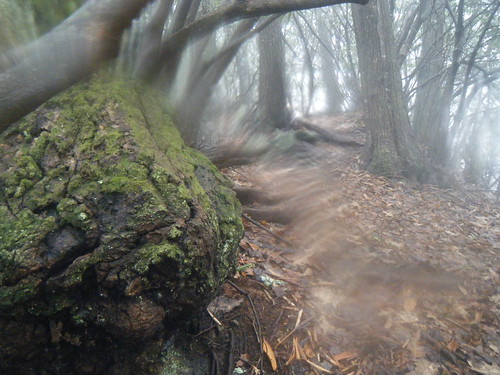
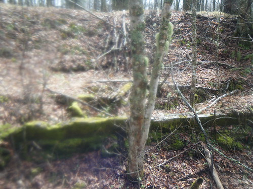
This interesting interlude took us back to the Mountains to Sea and continued our search for Buckeye Gap. We found another trail that looked right and took it. The fog was still heavy and I was wary of making another mistake. The trail looked right, again, and was heading in the right direction but seemed a little too maintained so we were cautious as we looked for the game cart. Like so many other trails in the forest the trail was built on an old rail line and I noticed how the grass was growing in furrows from where the rail ties used to be. In other spots long sections of ties where still in place and slowly returning back to the earth. There was no game cart but that didn't mean it wasn't the trail. SAWs and the CMC have been out working in the Middle Prong which would explain the recent maintenance so we pushed on. Finally, the clouds broke and I looked up to see Green Knob to my right and Lickstone Ridge to my left and knew it was indeed Buckeye Gap. That put a pop in our step as we continued on down. Along the way I found a bit of heavily engineered land as well as some old foundations and plumbing up there. I still find it strange that these woods used to be the site of such heavy and destructive industry but now the woods are recovering and the signs of man's folly are slowly returning back to the earth.
It was shortly after there that we made the turn to the west off the ridge and down to Grassy Ridge Branch, It was at this spot four years ago that Duma and I got turned around after my compass reversed polarity. You can go back to May of 2009 on this blog to read that story if you'd like but I remember it as well. We were coming up and couldn't find where the trail made the turn. To further complicate matters the fog was heavy and visibility reduced to just a few feet but if that wasn't bad enough my compass reversed polarity. North was reading South and everything was exactly wrong. I kept trying to find the trail by walking a number of bearings but nothing worked. Eventually I decided my compass HAD to be wrong - I'd never heard of such a thing but was confident North was really South - but decided to make the smart move and retreat back the way I had come instead of relying on an unreliable compass. It is a tricky spot, especially in summer when the trail all but disappears into a tangle of overgrowth, and is located incorrectly on several maps. This time Duma and I glided through without any questions.
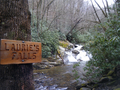
I'd forgotten how steep the drop down to Grassy Ridge Branch was and as we ran down the mountain I marveled at just how beautiful it all really is. Winter is slowly relinquishing her reigns to spring and blotches of green are beginning to poke out of the barren ground, the creeks, rivers and streams are all flowing healthy and new life is in the air. Grassy Ridge Branch looked very nice, with a long series of small waterfalls and I made a mental note to go back this summer with a rope. After a good vertical drop we made the turn onto Haywood Gap trail as we now followed the Middle Prong river itself. The trail was now rather flat by mountain standards and we were able to make good time and actually run for a change. Somewhere along the way I slipped on a rock while crossing a little branch and fell completely into the water. My legs and torso were totally submerged. It wasn't that far, or that close, back to the truck but I never got cold. The big crossing at Camp Two Branch was deep and slippery but I managed to make it across without going for another swim.
After that the trail slowly turns into an not too old road and then out onto a gravel road which we had to run down way too long to get back to the truck. Gravel is the last thing I like to run (one hundred pound dogs with big paws don't do well on gravel) but it had to be done....
No comments:
Post a Comment