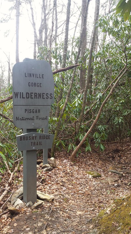
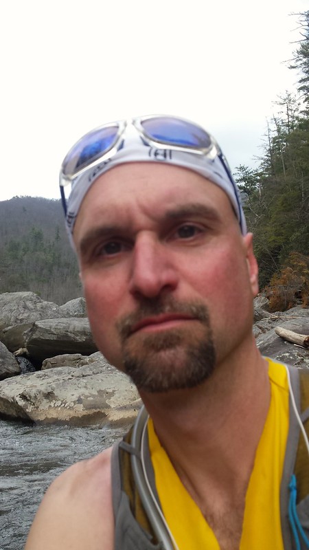
For my recent take on the Linville Gorge Half Marathon Concept I headed to the northern part of the gorge where I had sketched out a route that proved to be as good in person as it was on paper despite whatever initial miscalculations I might have made.
Bynum Bluff > Linville Gorge Trail > Brushy Ridge > Roads > Jonas Ridge > Devil's Hole > Linville Gorge Trail > Babel Tower > Kistler Highway
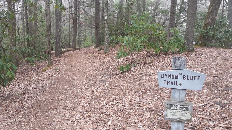
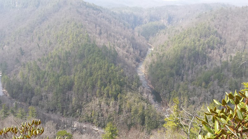
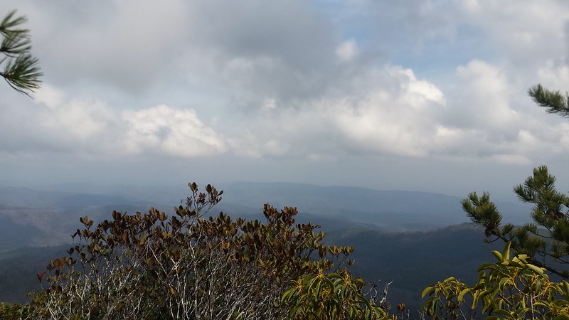
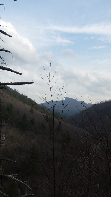
Things started innocently enough on Bynum Bluff trail. Of course Bynum Bluff Trail wasn't on my map but I figured that out and down I went into the gorge. The Descent was steep we didn't have near the elevation drop of other trails on the other end of the gorge such as Pinch In. I was happy to see recent trail maintenance as well as some nice views of the gorge.
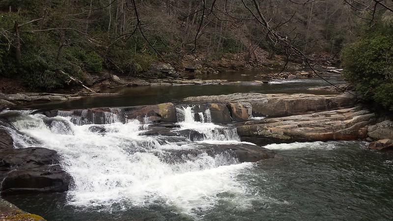
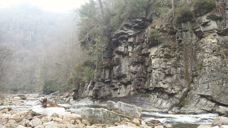
I really hadn't paid too much attention to the map but knew that once I got to the river trail I needed to go right and then after a short ways for the river and take a trail up a dominant ridge. So, when I got to the river I went right instead of looking for any signs of a crossing or trail on other side. I hadn't seen much when I encountered a group of trail workers who asked where I was going and when I said ginger cake mountain they told me I was on the completely wrong side of the gorge. I knew that, and told them I was planning on crossing the river. I didn't know the trail name but they quickly told me it was Brushy Ridge and offered to give me directions. Sometimes I am wary of receiving directions from strangers in the woods but these people were with Linville Gorge maps.org and obviously knew the court as well as anyone. They marked my map and gave me detailed instructions including how to get to ginger cake without having to do too much on the road. I thanked them and headed back up the river a little ways where I was told to cross just above this waterfall.
This ford wasn't very deep but was still quite slippery and by crossing the river I was committed to my route. Once across I spent some time wandering up and down the river bank looking for Brushy Ridge and marveling at the beauty of the gorge.
Eventually I spotted a stack of rocks and something that vaguely looked like it could have been a trail at one time and up I went.
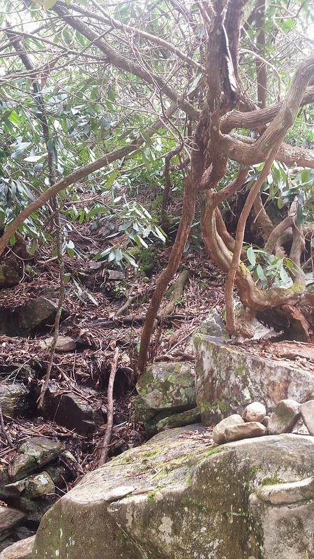
The trail was steep and overgrown at the bottom but steadily improved as I made my way up. Once again I was happy to see the third been very recent Trail maintenance done and the trade was in great shape at the top. And as always the views were amazing along the way.
Brushy Ridge ended in a neighborhood and from there I wandered through some streets looking for Rhododendron Way which I had been told it would save me some road miles. A mail carrier drove by and I figured who better to ask for directions but then but of course they'd never heard of Rhododendron Way. I kept running along knowing eventually I would find something that would get me back up into the gorge when I saw a truck at a house that looked familiar. I had ridden with a guy named Phil who lived in the area and I thought it was bound to be his house. There was a woman unloading a bike and I asked if it was Phil's house and she said yes, Phil is her husband. Rhododendron Way was directly across the street and she gave me detailed directions to Jonas Ridge trail and wished me luck as I continued running on.
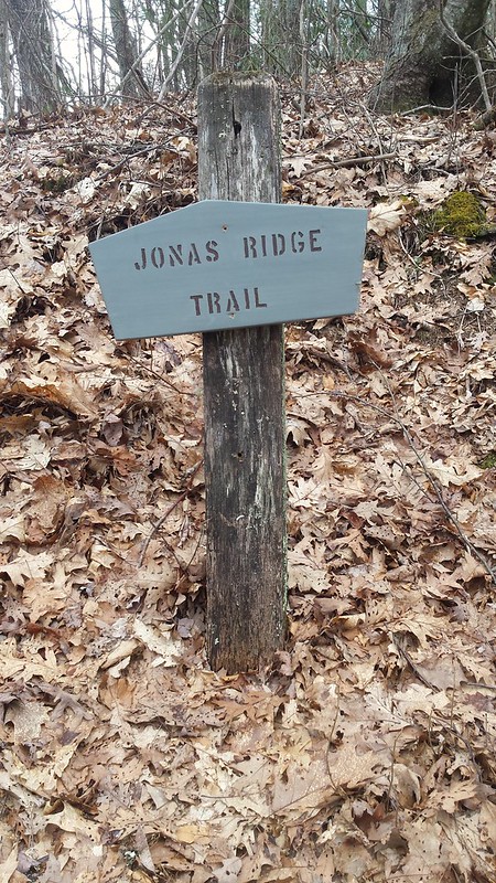
Jonas Ridge was a great trail. Not overly hard with not surprisingly amazing scenery.
While Jonas Ridge had been rather mild as far as trails in the gorge go, Devil's Hole was a nice little stretch of trail hell. It was either so steep that it required full on scrambling or was little more than an impossibly rocky dry stream bed. But it wasn't very long and ended at the river where I once again would have to cross.
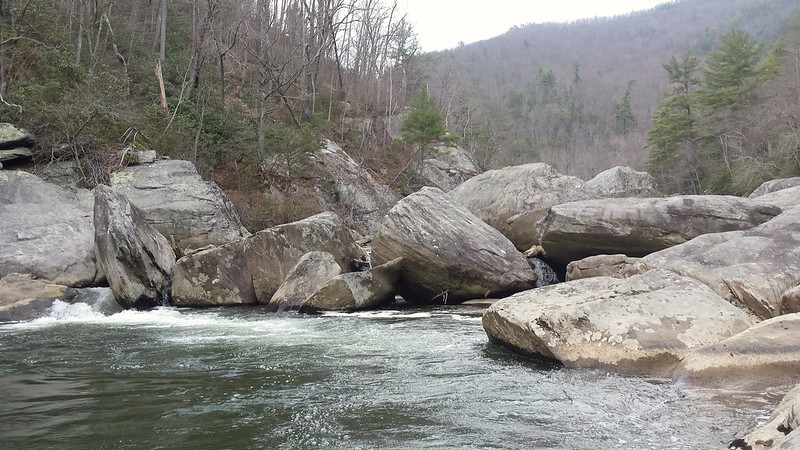
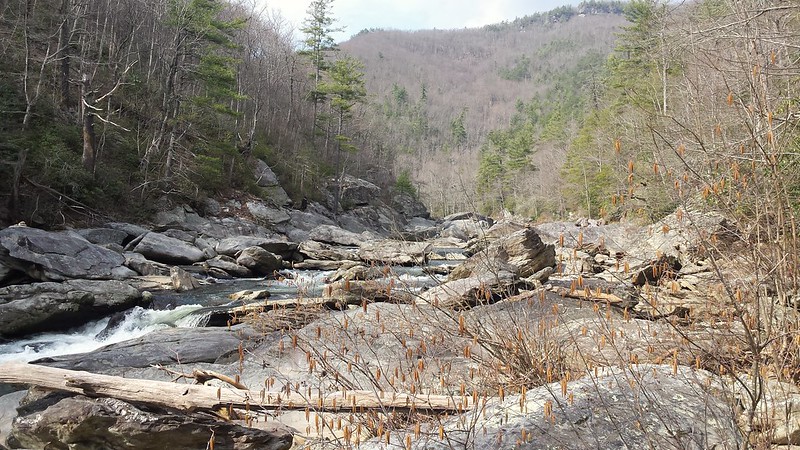
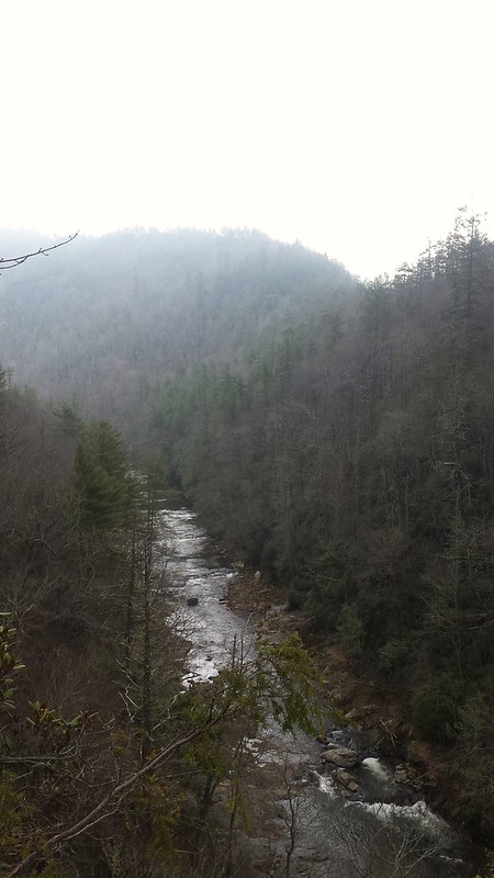
This ford was much more difficult than the first. There were some places where it looked like I might have been able to rock hop but the rocks were exceedingly slippery and the penalty for error was too much for me to chance on my own. I spent quite a bit of time working my way up the river bank looking for a safe place to cross. Standing on the riverside I was truly taken back by the pure beauty and splendor of this wild place I was in. I had seen several groups earlier in the day but now suddenly seemed totally alone in the wilderness.
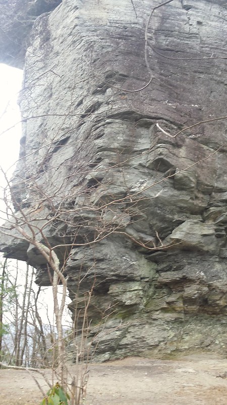
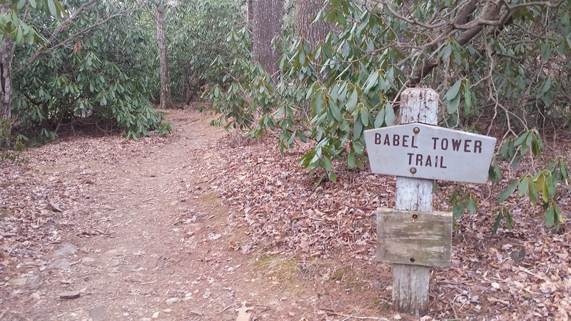
I couldn't just stay next to the river forever so after much scouting I found a nice and wide place to cross where the current wasn't very strong. That meant that it was deep and the crossing required a full on swim to get across. Once I reached the other side it was just a short scramble up to the Linville River Trail. The LGT trail might just be the most difficult trail in the gorge regardless of how 'flat' it might be. By the time I reached Babel Tower I was ready to be done with the run and headed straight back up and out of the gorge.
In the end this take on the Linville Gorge Half Marathon concept came in at 16 miles with almost 5000' of elevation gain. Ouch!
No comments:
Post a Comment