Wednesday, March 26, 2014

Middle Prong to Shining Rock Marathon

On the drive to Sunburst on Saturday Yuri remarked his plan was to take it easy on the run. I had to ask if he had looked at the route I'd picked out for us as there was nothing easy sounding about it to me and I was a little worried about how hard it really could be.

middleprongtoshiningrock

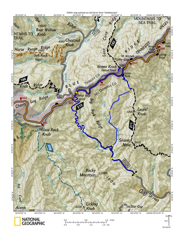
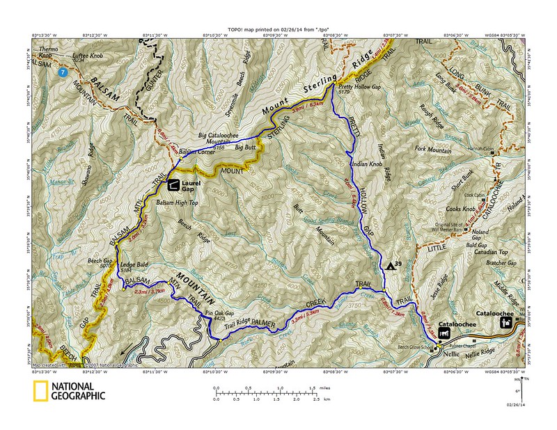
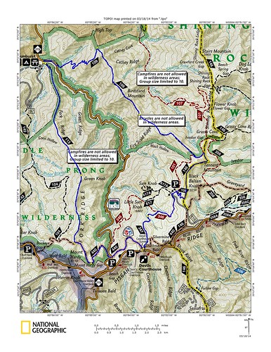
Green Mtn. > Mountains to Sea > Little Sam Knob > Flat Laurel Creek > Art Loeb Spur > Art Loeb > Black Balsam > Art Loeb > Fork Mtn.

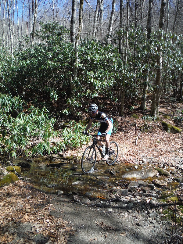
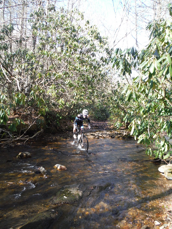
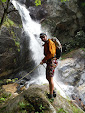
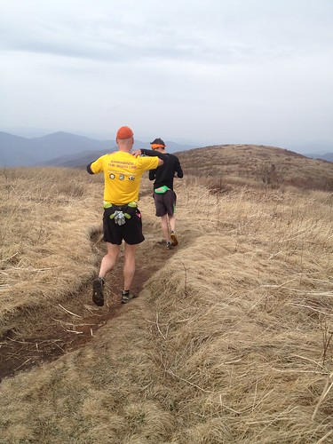
Green Mountain trail #113 in Middle Prong Wilderness and Fork Mountain trail #109 in Shining Rock Wilderness are likely the two least traveled and most difficult trails you will find in the Pisgah Ranger District. I've done both trails before and knew exactly what to expect: insane elevation changes over very rugged terrain, bountiful views, twisted rhododendron tunnels, disappearing trails and few people. They are my two favorite trails in the forest. We were traveling light and other than my shorts, shoes and shirt I was armed with only arm warmers, gloves, wool cap, two bottles of water, a dropper of bleach, lighter and a thousand calories. There would be no lollygagging this day.

Green Mountain trail climbs steeply from the start and I tried running.

photo 2(3)

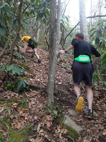
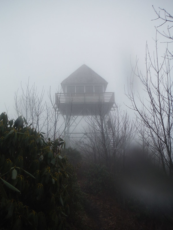
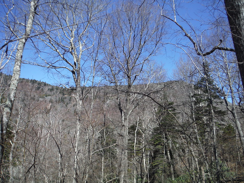
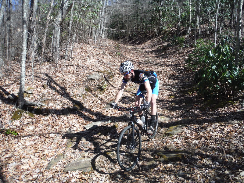
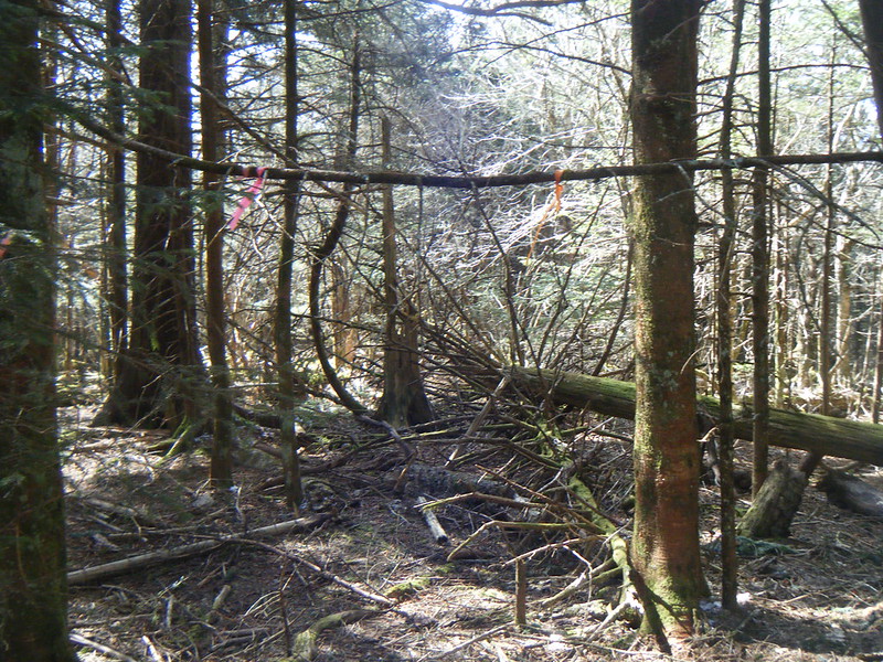
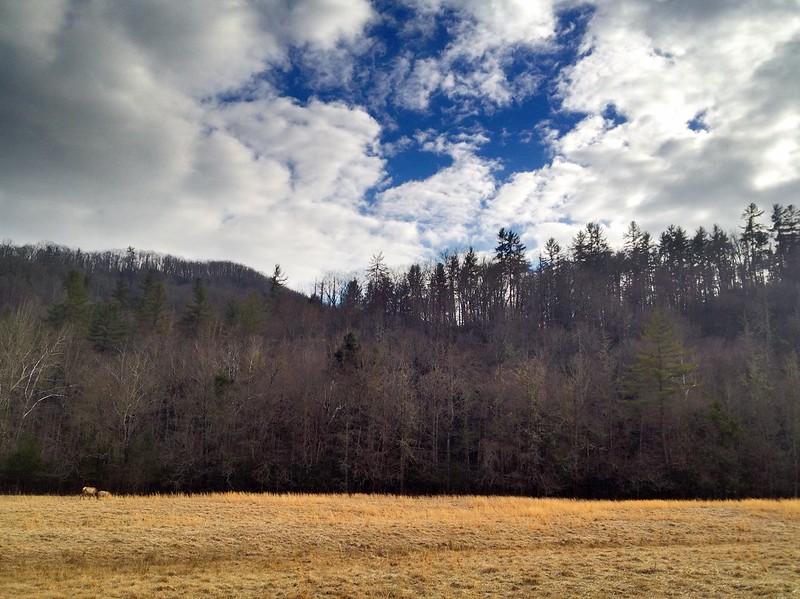
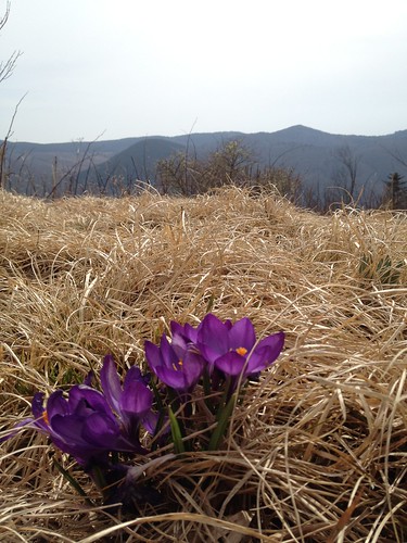
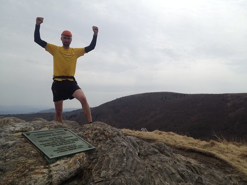
That first pitch levels off a little after a few hundred vertical feet but the next four miles are still very much a serious climb. Every once in a while you top a little finger and get a brief flat stretch but that is often combined with rhododendron so tight that you have to run or hike hunched over. After almost three thousand feet of climbing you top out on Green Knob and the trail begins to go through several different patches of high mountain balds but unlike most of the balds in the area these have a great sense of solitude to them.

photo 3(1)

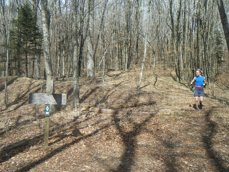
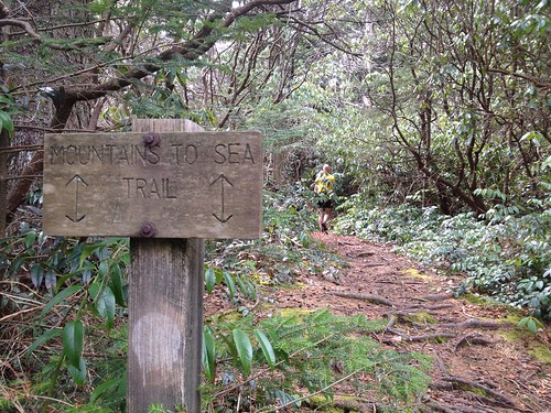
We made the turn onto the Mountains to Sea trail and briefly discussed going the short way to the top of Mt. Hardy but we all agreed that we still had a long way to go and even a short way out of the way should be avoided if possible so we passed on it. The MST through Middle Prong is flat, twisted and slow going. Somewhere on it Yuri remarked that we were already over nine miles in. I did the math and realized that if the run was only 18-20 miles, as I had thought, we should only have been seven miles in. It would be over 20, that  much was for sure.

At highway 215 we could have taken Flat Laurel Creek but instead stayed on the MST and started climbing up towards Devil's Courthouse. I had been eating all day but my thousand calories were already cut in half and I was starting to worry about food; I was bonking a little and had moved from the front to the far back of the pack.

photo 1(1)

photo 4(1)

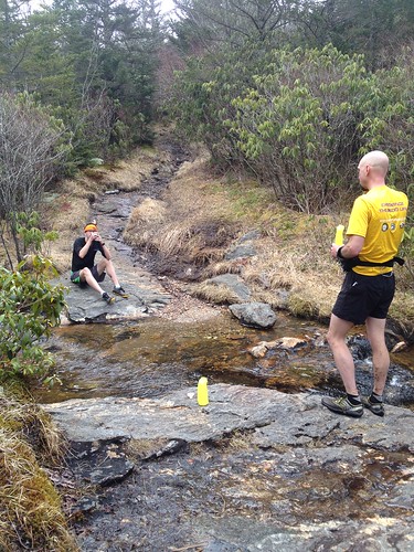
Down Little Sam, up Flat Laurel Creek to the Black Balsam parking lot and it is decision time again. Do we go over the top of Black Balsam Knob and Tennent Mountain or do we stick to Ivestor Gap trail and take the flat and easy way? We opt for the two 6000' peaks, of course. We stopped at the spring for our last chance of water until the end of the run where I popped a hit of caffeine and ate half of my last Snicker's bar before we took off across the wide open balds. It was a perfect early spring day and I was suddenly feeling great. The lows I had felt on the MST and Little Sam were gone and I was running strong and fast.

photo 2(2)

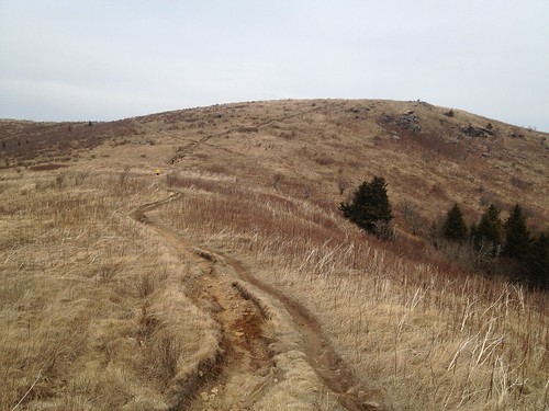
Art Loeb III and the many social trails that weave around these balds are some of the most treacherous erosion gullies you will find around but this day I found them surprisingly runnable. While the solitude over the Wilderness had been shattered by the throngs of people this section still made for some truly excellent running. We paused briefly on the top of Tennent and I showed Jon the long ridge with all its various peaks that the Fork Mtn. trail would take us across.

photo 5

photo 2(4)


Fork Mountain is seven of the best miles of trail you will find in Pisgah. And also seven of the hardest miles. After 18 miles of hard mountain running the trail took its toll on us. We spread out, each of us enjoying the trail's beautiful misery on our own. For most of it's length Fork Mtn. follows the ridge line and twists, turns and climbs up and over Birdstand Mountain. It might look flat on the map but it is anything but flat. But it is oh so good!

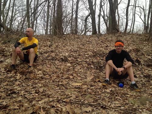
After five miles or so we finally reached our final intersection of the day where we would finally begin to descend back down to Sunburst. We were all pretty spent by this point and we took a minute to relax before we summoned our final bit of strength for the home stretch.

photo 4


Those final miles drop 2000' straight down. If all the climbing hadn't been enough this final pounding was certain to fulfill any wishes for the run we might have had.

25 miles. Seven hours.


Thursday, March 20, 2014

the mountains win again

Everyone bails at some point. It is never fun and is always humbling but sometimes it just happens. It has been awhile for me but my number came up last Saturday at the Green Knob lookout tower. We were just four miles into a 18 mile run and as I struggled with a glove change in the freezing rain Jon suggested that we head back down to the parkway and then back down to the trail head instead of dropping the Lost Cove trail down into the South Toe valley and I happily agreed. I started the run already tired and the cold rain made me tired of winter and tired of running. Going back the most direct way seemed a lot more sensible than torturing myself with an extra seven miles so directly back down we went.

I'd gone into the weekend with the best of intentions of training, whatever that might be, for the upcoming PisgahProductions adventure races. On Saturday I got out for a really good roughly 40 mile mountain bike ride that pieced together all the seasonal trails in Pisgah.

3-15-14

This is one of my favorite routes and a short while into it I decided to see how hard I could push it and vowed not to stop until I got to the start of the mandatory hike a bike at the top of Horse Cove Rd. I was feeling very strong and that plan worked well. Clawhammer barely felt like a climb and before I knew it I was at the Fish Hatchery with Bennett but just a dream. I took my helmet off for the hike and just took it easy and used the walk as an excuse to eat and drink and enjoy nature but before I knew it I was riding down North Slope and back at the truck in under five hours after departing.

So on Sunday the plan was to start at Newberry Creek and do:

Newberry Creek > Orange Blaze > Snook's Nose > Lost Cove > River Loop > 472 > Newberry Creek

And from the start Saturday's heroics had left me out of gas and Duma and I were struggling to keep up the rear. The Orange Blaze trail is as big of an ass kicker as you'll find around here. Over the course of just a few miles it gained more than just a few thousand feet of elevation and what we call a run was more of a long, hard hike.

When we hit Snook's Nose it should have returned to running but I was still hiking. The rain had picked up and as we gained elevation the temperature dropped and the wind increased. By the time we hit the Blue Ridge Parkway the rain stung and then froze as soon as it hit my face.

 On the way up Lost Cove to the Green Knob Lookout Tower all I cold think about was how cold I was, how tired I already was and how long of a slog it was going to be back up the gravel road after dropping down to the South Toe River. I know it is the long painful climbs that make you want to bail and know that if you just push on through to the other side you will begin to feel better just as soon as you start to descend and then before you know it you will be better than ever. But no matter how rational I make it sound sometimes emotions win and just one more mountain isn't worth it anymore.

DSCF9446

As predicted the descent was shamefully easy. I warmed up fast. Duma got a pep back in his step. Jon took off. What should have been a hard 18 came in at a hard 11.

3-16-14


Thursday, March 13, 2014

madien voyage #14

What most people would do if they just got a new handmade custom cyclocross bike is something like the classic 1206 > 276 > Blue Ridge Parkway > 5000 loop but Yuri isn't most people and I'm not normal so for his inaugural ride on his new 44 Bikes bike we started from the PRD Fish Hatchery and headed off for a pickle of a waterfall  on the sort of ride where you need at least two different maps.

004

We quickly climbed up to Gluochester Gap and then dropped down to highway 215 and then climbed up again. As we neared to the top of the pass we took a left and headed into the Nantahala National Forest where our target lay. There were a lot of different forest roads on the maps to pick from and I steered us toward the uppermost one. We found it clearly signed right where it was supposed to be and we headed on up. It was steep and rocky and quickly turned into a hike a bike for me on my single speed but other than a few dismounts Yuri put on an impressive climbing display as I stared up at the mountain.

007

At the crest of the road we took a slight detour up another old road to the top of an old grassy bald. The forest is slowly recovering this land and it is a special place off the beaten path and made the perfect place to enjoy a toast and moment with a friend.


011

It was all downhill from there and once again Yuri showed that a cross bike can hold its own in these woods.

012

016

When we got back down to the bottom of the road there were several different roads to pick from. We checked the maps and poked around in the bushes to try and decipher which way to go as nothing seemed to match or add up.

021

We picked what we thought had to be the right road and headed up and around the mountain towards our target waterfall. After riding the road for way too long we got to the same intersection where we had been hours ago shortly after leaving 215. This was all wrong as we should have passed the waterfall along the way so, we pulled out the maps and the gps and tried and make sense of it all.

024

I had been to the waterfall before but via a different route. The roads on the two different maps didn't match and the roads and waterfall weren't even on the gps so it took us a minute to stumble the short distance down to our destination.

026


We let the multitudes of negative ions being released by the waterfall soothe our souls for a few minutes and then we crossed the creek and headed down a long road that has been forgotten long enough it is now a true single track trail. It was tough enough that I was glad to be on a fat tired bike but Yuri continued to hang right with me.

034

It is amazing the stuff you find sometimes when you take the time to look around you.

039

After several fun miles the trail ended on an asphalt road which led us out to highway 215. A quick plunge down the mountain and we were quickly back in Pisgah and climbing up Indian Creek Rd. to the gap again. Another excellent adventure in (and out of) Pisgah in the books!

043

Wednesday, March 12, 2014

tuesday's gone

 With temperatures in the seventies yesterday was better spent playing than working. I finally got to try my new canyoneering shoes and then squeezed in a quick North Slope ride before heading home to run the dog.

051

053

062

065

071

074

075

079

093

097

102

103

105

110

113

Friday, March 7, 2014

Big Catalooche

Last weekend's adventure took me to the Great Smokies National Park and to the top of the 6155' Big Catalooche mountain. This 22 mile run put the Big Hurt on us.

Palmer Creek > Pretty Hollow Gap > Mount Sterling Ridge > bushwhack to summit from Balsam Corner > Mount Sterling Ridge > Balsam Mtn. trail > Balsam Mtn. road > Palmer Creek trail

>bigcatalooche

It looked like that except we did the Sterling Ridge trail from Big Butt to Balsam corner twice thanks to the bushwhack.

Pretty Hollow Gap was a steady climb all the way up but never got too steep and I made the mistake of running it all. The stretch across the ridge trail was way too flat for way too long for me and it was then I started to get really hungry and realized I was not going to have enough food to get back down. The bushwhack was a pleasant relief from running and I ate what I could on the way up being careful to save a few calories for later in the day.

At the top of the mountain there was nothing except a few pieces of flagging tape. The big views I was hoping for weren't there but Jon had a bunch of bars in his pack and was nice enough to give one to me which I very quickly scarfed down.

DSCF9312

Back across the ridge again and then a quick stop at the Laurel Gap shelter which was much nicer than I ever would have expected.

DSCF9313

DSCF9315

Then it was finally time to start going down and I led the way down the first steep pitch to Beech Gap.

DSCF9316

From there it was a long series of ups and downs out to the road and the bar Jon had given me was quickly forgotten. By the time we got out to the road I was bonking hard and thinking seriously about beating Yuri up so I could steal some of the food he was carrying and not sharing. When we got to the Palmer Creek trail I was very dismayed to see we still had another five miles to go and when we paused briefly at some scientific equipment Yuri pulled an energy waffle out of his cornucopia. I'm not sure if he was trying tease or taunt me but I immediately made arrangements to purchase it from him for a dollar in cash as soon as we got back down alive and he reluctantly handed it over.

With those few more precious calories I decided to look at my altimeter to see how far we still had to descend and saw that we were still above 5000' and hadn't really started the descent yet. The initial big climb coupled with the rocky terrain had my hip flexors yelling at me to Stop Now but five miles is too far to walk so on I ran. I was well in the back at this point and when I made it to the intersection with Pretty Hollow Gap I yelled "Ouch!" and was very relieved when both Yuri and Jon vocally agreed with me.

That only left 1.6 miles to go though and I knew we would make it. I decided to suck up the pain and try to stomp out the last miles as fast as I could to make it end as soon as possible. A cooler full of recovery beverages just down the trail was all the motivation I needed and before I knew it I was back at the car and sitting in the grass with Jon.

Yuri came in a couple of minutes behind me and when he heard that we had gone 22 miles he suddenly forgot the pain of the previous miles and wanted to do another four miles so we would get in a full marathon to which Jon and I just chuckled and then firmly said no. Ever the explorer and bargainer he then wanted to show us some stuff around the bottom to which we said "maybe next time".

There was a steady stream of cars driving around looking for the elk and as we left the park. I was very content to be riding in a car playing tourist and looking at the woods pass by through the window.

photo