Saturday, January 31, 2009
No Phish Tickets
Turns out there isn’t much to it. An old road bed that is very overgrown and very hard to follow. So much so that it only took a few minutes before I was wondering just where the road cut was so we turned around and headed back to the truck. From there it was on up 5000 to an old gate on the left past Bad Fork. I see vehicles parked there frequently and wondered what was beyond the gate.
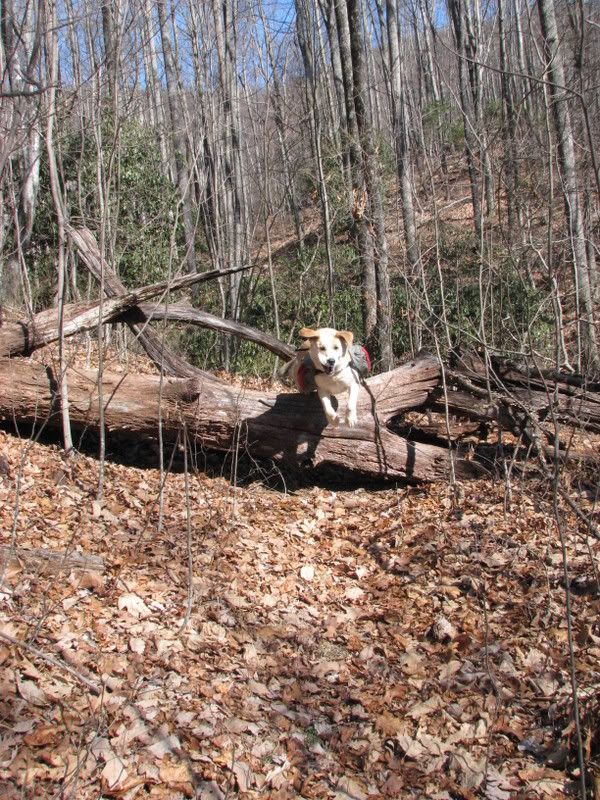
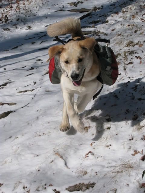
Well, a hundred yards or so down the road are a few nice campsites that I’m sure are what are being used by the vehicles I see. Duma and myself pressed on determined to see where this old road led. It was hard to follow, especially after we crossed a bridge that obviously wasn’t supposed to be crossed, but after a few minutes of bushwhacking we crossed the creek again and picked up the faint hint of trail. Duma was having a blast running all over the place:
Before too long things started to look rather familiar and we were spit out at the wildlife fields where Spencer Gap trail breaks off from Ferrin Knob Rd. We took a left on Ferrin Knob Rd. and followed it for a good while and turned around just before Beaver Dam Gap. It was a very nice day for a little relaxed exploration and whatever frustrations I’d had were long forgotten.
Tomorrow is going to be a gear test ride for the Horrible Race. I have my sleeping bag strapped to my handle bars and am going to try riding with water bottles instead of a camelbak bladder and have put all my tools into a seat bag. Suddenly my bike is extremely heavy but my pack is light. I’m not sure how well it is going to work but I’d rather test it now rather than at midnight next Friday. Headed straight up Black - a good way to test it out!
Sunday, January 25, 2009
Old Toll Road
Those are the types of things that seem to be said about the Old Toll Road route to Heartbreak Ridge. I’ve been feeling the itch for some new mountain rides recently and decided that this weekend was the time to do Heartbreak. I hadn’t ridden it since the ‘07 ORAMM and had only taken the Curtis Creek route in the past so I was due and due for some Old Toll action. Attempts at getting a friend who knew the way proved futile so Broussard and myself left from the top of Kitsuma to find our way Saturday morning. I had done some research on the route and had the topo map and figured if we could find the start of the Old Toll Rd. it would be easy enough to follow to the top by just ignoring any turns that appeared regardless of if it seemed like we had to be a the top by then. I was tempted to try and find the road up through Ridgecrest but we played it safe and spun our way through Montreat.
From Montreat I knew we had to somehow find Lookout Rd. and follow it to Rainbow Rd. Miraculously Montreat’s roads are signed so finding the roads was a non issue. Once we got onto Rainbow Rd. there were a few turns to chose from but once again there were signs indicating what was what and picked up the Old Toll Rd. without a problem. From there it was just climb, climb, climb and climb some more staying on the obvious road bed and ignoring any turns. I was surpirsed at how moderate of a climb it was and except for a few brief dismounts Zach and myself handled it without a problem. A quick stop at the top and then we were bombing down Heartbreak.
Fast and fun! There are a few turns but we both knew them so navigation was a nonissue. Heartbreak is one of the best downhills around and I was having a blast riding something new. Nothing lasts and before we knew it we were down to the railroad tracks and opted to take the gravel back up instead of doing Kitsuma backwards.
We had zero navigational issues and I’m a little baffled why a guide would be needed. If you do a little research, have the maps and some common sense the Old Toll Road is very doable. I’d be much more hesitant to send somebody the Curtis Creek route without a guide….
Sunday, like usual is for not doing much but I did manage to take the dog out for a walk.
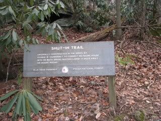
Shut In from the bottom to the first intersection with the parkway. Good stuff, can’t wait to do the whole trail!
Tuesday, January 20, 2009
Snow Day!
Freshies!
Monday, January 19, 2009
Black Mountain Bitter
The top of Black is not necessarily an easy place to get to but it is one of my favorite spots in the forest and I was eager to go. After a little peer pressure Dennis was game and we discussed our options. As much fun as climbing Turkey Pen is I wanted to actually ride at least a little bit so I opted to save that for another day. The Squirrel > Black > Turkey Pen route is a ton of fun but is a fairly big ride and you have to be committed to pull it off and since I needed to be in Asheville by late afternoon I decided against it as well. The only other option was to take highway 280 down to Pisgah Forest and then climb Black up to Turkey Pen. I’d never done that loop before and it sounded like the easiest way to get to the top so that is what we did.
On the way down 280 it became clear that it was indeed cold outside and we were riding straight into a fierce and frigid headwind and I was spun out on my silly singlespeed. I kept reminding myself that once we started climbing things would warm up quickly. It took an eternity before we got to the start of the Black Mountain trail and then sure enough once we started up we started to warm up. The last time we had climbed Black Dennis put on a very impressive climbing display and I wondered if he would be able to duplicate it in the cold weather. By the time we approached Hickory Knob he was having to push some and it was clear the cold was taking its toll on both of us. We made the intersection with Turkey Pen in 1:10, a good time considering the conditions, but still had to keep going up to the first look out to enjoy our beers. By that point the sun was out and we were thinking it would be nice up there and I enjoyed the little technical stretch of riding to the first look out but when we arrived we were immediately greeted by the same cold wind that had been down on 280 and it was anything but nice.
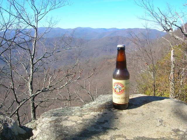
The things a man will do for a cold beer. Cold Mountain Ale the day before and now this. Chug a lug!
It was so cold I couldn’t even taste the beer and after shoving some gorp into my mouth and adding layers for the descent we were off. Turkey Pen Gap is a ridgeline trail and was very exposed and very cold. My water was frozen and I was tired and we just kept going. Despite the conditions the first descent into Muleshoe Gap was pure gravy like always and after that it was just more crazy descending followed by short hike-a-bikes. We made the parking lot in a cold hour and were back at Dennis’s in minutes. I’m not sure how much fun the ride was and wouldn’t be surprised if I’m not allowed to pick the routes for awhile.
For the first time in a long time I didn’t feel like going out for an adventure on Sunday. I guess two days of playing in very cold weather took its toll on me. Further examination of the Black Mountain Bitter Pale Ale reveals that it is nothing too special so luckily I won’t have to duplicate Saturday’s ride to finish them off. Now the snow is falling and I have freshies on my mind. Tomorrow might quite possibly be a snow day and if the roads are safe the D-Man might just get an adventure!
Saturday, January 17, 2009
Cold Mountain
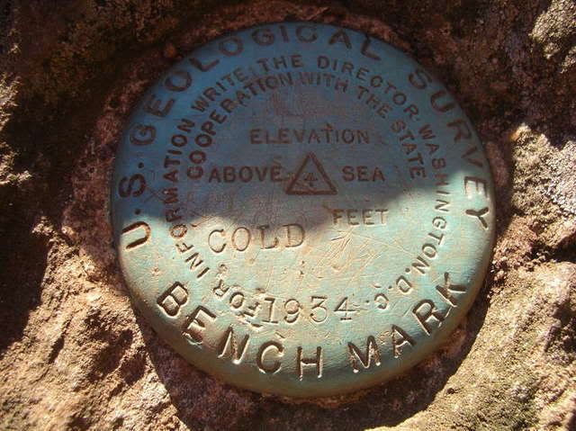
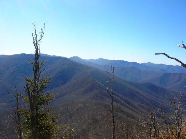
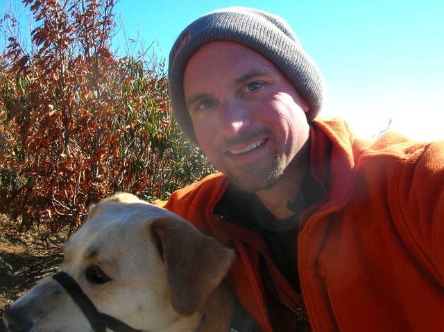
Safety is always my top priority so I headed out with the mindset that it was okay if we didn’t make the summit. I set a mandatory turn around time of 1:30pm and vowed to turn around earlier if Duma or myself got too cold. The temperature wasn’t a problem and the only time I was remotely uncomfortable was when I had my gloves off. We started at 9:45am and were on the top of Cold Mountain by 12:10pm and back down at the truck at 2:45.
I took the crappy point and shoot so here are some crappy pictures:
Lots of water on the trail including this spring: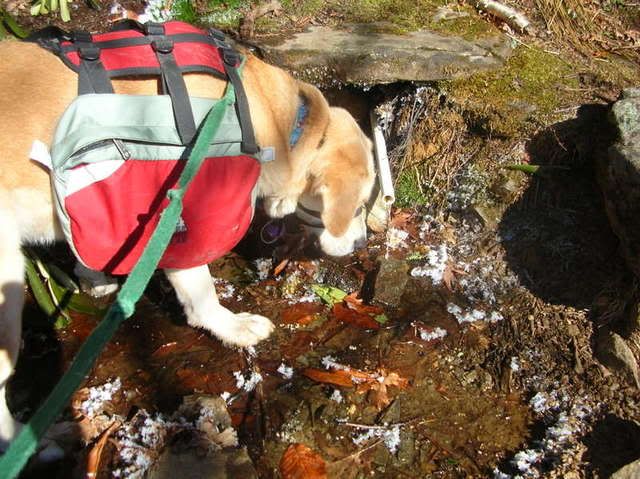
I met two groups of hikers on the trail along the way. It seems I wasn’t the only one who thought the coldest day of the year was the perfect time to hike Cold Mountain. Unlike myself they had all opted to spend the night last night. Good for them!
I stopped at the grocery store tonight and picked up Highland’s newest seasonal offering - Black Mountain Bitter. Looks like I’ll be going up to the top of Black tomorrow. Climbing Turkey Pen?!
Thursday, January 15, 2009
Drinking Club
The Most Horrible Thing Ever is coming up quickly and I don’t know what to think about it. I’ve barely been riding and keep drafting ‘training plans’ but can’t quite seem to stick to them. My most recent one is scribbled on a coffee stained piece of paper and looks something like this:
TMHTE Training Plan:
1 - Sleep
2 - Stretch
3 -
Either I couldn’t think of anything for #3 or abandoned the plan before I even finished it. To further complicate matters my tendonitis is still lingering and will probably still be there in three weeks on race day.
The other big news is that it is cold out. Very cold. Work today was quite simply painful. There I’ve been itching to hike Cold Mountain and with tomorrow possibly being the coldest day of the year and my supply of Cold Mountain Ale quickly vanishing I’d like to do it tomorrow but fear that it might be too cold. I’ll see how I feel in the morning but if I don’t do it I’m blaming it on the dog!
Tuesday, January 13, 2009
Maps and Legends
For a long time I’ve been staring at my Grandfather District map and dreaming of doing a gravel grinder that circles the Linville Gorge. Time and time again I found myself pulling the map out and looking at the route. It seemed pretty clear – roughly 50 miles of gravel and a little pavement – but I know the Grandfather District isn’t always very well marked and what is on the map might not be what is on the ground so I never found a good excuse to get out there and do it until this past Saturday.
I proposed the idea to some friends and they were all game so we ignored the good chance of rain and headed out Saturday morning to do it. Zach being the prepared type had done some real research on the route as opposed to my drooling over the map so he played navigator, David Cook was the driver, Dennis the drunk and I was the lone single speeder. According the info Zach got there was only supposed to be 6000′ of elevation gain but all we did all day was climb, climb, climb. I know I’m out of shape but there is no way it was only 6k vertical. This was right up there with my biggest vertical gain days. And not only was it a lot of climbing it was a lot of very steep gravel climbing and I was resigned to walk much of the day. Eventually even Zach and Dennis were pushing. Cook, who had claimed to be out of shape, was riding strong all day and if he ever got off to push he was too far ahead for any of us to witness it.
Here is the route, courtesy of mapmyride:
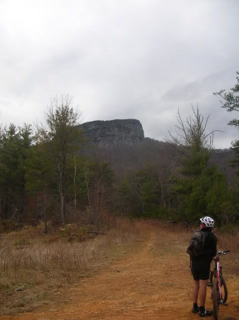
We spent the first part of the day on the East side trying to beat the rain and working our way up and around Table Rock:
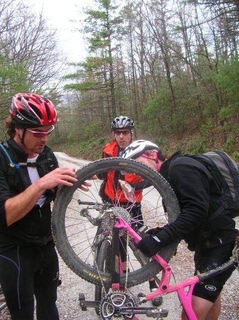
Along the way there were a few mechanicals but we were all motivated to keep moving. Notice the serious look on our chief mechanic’s face – he decided this mechanical wasn’t worth his time:
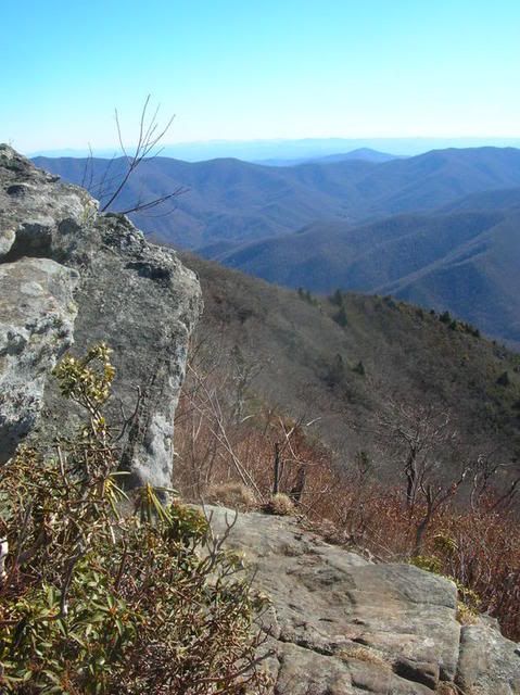
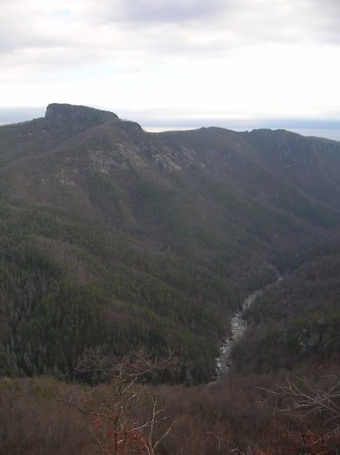
Miraculously we somehow eventually made it to Wiseman’s View and all that climbing seemed worth it:
After Wiseman’s View Zach had been promising a 12 mile downhill but it never came. We would get a little downhill only to be faced with an ever steeper climb. It was unrelenting and by the time we made it back to the truck we were all done. It was a big ride. Lots of climbing, incredible views, no single track and one of the most fun and painful days I’ve had on the bike in a long time. I’m not sure it is the type of thing I want to do again.
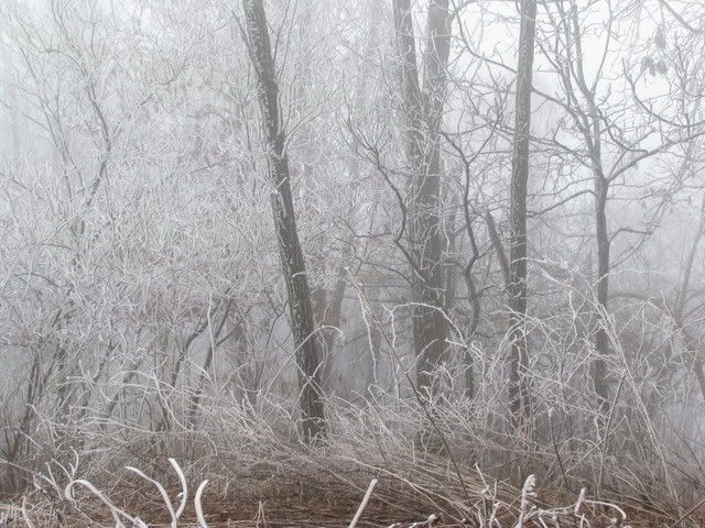
Sunday is to relax and my dog was pissed about being left all day Saturday so we headed out for a little hike and did our usual Bad Fork but when we got to the parkway I decided to add a little extra and headed up the Shut In to the top of Ferrin Knob. According to the map there is a fire tower and I wanted to see if it was still standing. When we started it was in the 40’s and mild out but as we climbed above the parkway it got cold and then we were faced with frozen fog and then snow flurries. By the time we made it to the top of the knob where the fire tower no longer stands we had climbed 1800′ and were both ready to go back down. Another weekend come and gone!
Sunday, January 4, 2009
Shuttle Run
The reason I started this blog is so that I can have a record of all my rides and hikes and whatnots. It started with a little notebook where I have kept track of all my Pisgah rides and just grew from there. For the first time in a long time I found myself reaching for my road bike last Friday and I wondered how long had it been since I went for a road ride. Well, a quick check of the blog revealed that I hadn’t touched the road bike since mid-October and the bike looked neglected. The cables were all rusted and the chain was needing a cleaning and some lube but the most I could manage was a few pumps of air and then I was out the door and headed for my usual Davis Mtn. short little loop. I tried to stay seated as much as possible and tried not to hammer but as soon as I hit the hills my legs and knee were feeling warm so I just went. It was a good quick little ride and I was reminded how much smoother a road bike is than a rigid single speed mountain bike. The roads were very slick and the little tires felt weird underneath me and then coming down the backside of Davis Mtn. at 40+ mph a dog ran out in front of me. I grabbed the brakes a little too hard, my rear tire left the road and I started skidding on the front. Somehow I got out of it before it went from scary to bad and on down the road I went.
My dog wasn’t amused when he didn’t get to do anything on New Year’s Day so I tried to make amends by taking him for a hike with Terri later Friday afternoon. We picked my new haunt – The Green River Game Lands – a did a nice little loop:
Bishop Branch > Rock Hop > Pulliam Creek
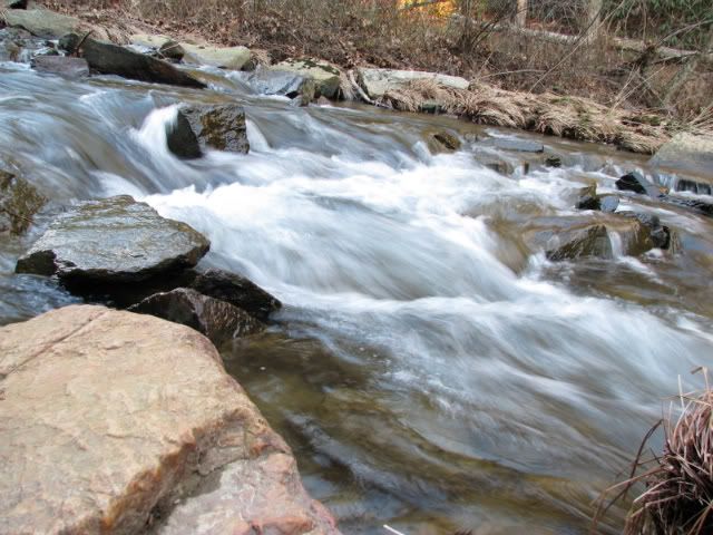
Regardless of what the maps say there are many waterfalls in the area and in the barren winter landscape there is no better photo subject matter than waterfalls so once again I found myself sliding down steep banks to play with the camera and try and get some shots. One of them required a fair amount of bushwhacking followed by creek walking where both Terri and Duma thought I was crazy but I made it to the base of the falls and spent a few minutes playing with the camera trying to get a decent shot without much luck. We stopped at the bridge over Big Hungry River on the drive home and took a few more shots during which I discovered how to use the camera:
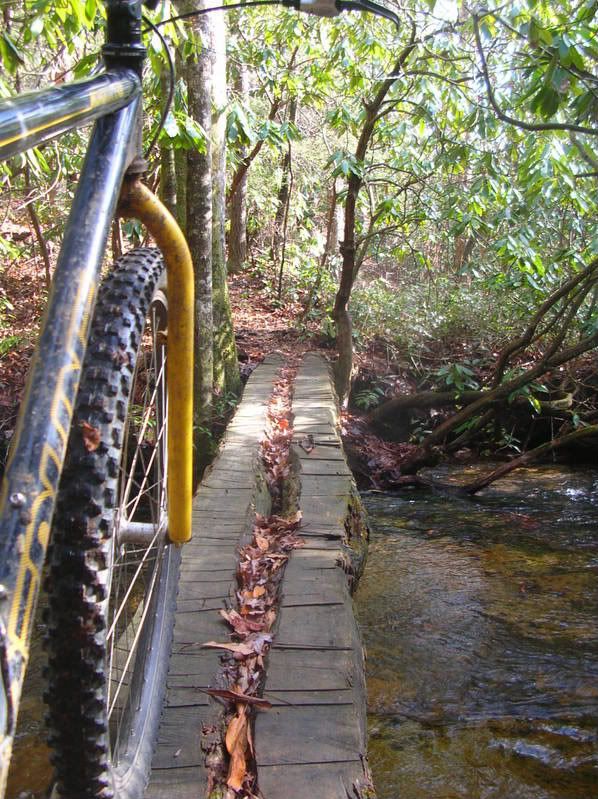
Saturday I decided to skip Cold Mountain and go for a mountain bike ride instead so I loaded up and headed to the Fish Hatchery for a fun little loop. I started by climbing Cat Gap and Butter Gap and was surprised by how moderate of a climb Butter is. Except for a little push near the gap it was all very climbable. As I was climbing up 471 after Butter I noticed an old gate and a few old blazes off in the woods and made a mental note to come back with the dog one day and check it out. I paused at the top of the climb to loose some layers and enjoy a snack and pulled out my map and noticed the gated road I was sitting at turned into an unimproved road and most likely hit 471 right where I spotted the old gate. Since it is on the map and isn’t signed as a wildlife road on the ground I consider it bike legal and just had to check it out. After a little bit of buff gravel riding I found the unimproved road and took it. Just like I expected it was much more of a trail than a road and I did see evidence of where other bikers have ridden it. It started off very buff and very fast, twisting and turning through the trees over some heavy leaf litter. Then suddenly a few tight switchbacks popped up along with some off camber technical spots. The trail was steep and leaves were deep and I was loving it! It isn’t often I find new Pisgah singletrack! It was over all too fast and immediately on the other side of this rideable but sketchy bridge was 471:
It didn’t end at the old gate like I thought it would and I was surprised I had never seen the bridge from the road before. I’m purposely being vague so if anyone actually reads this blog and wants to ride this little bit of singletrack you’ll have to study the map on your own or go for a ride with me. I’d imagine whenever I’m hitting Butter in the future I’ll be taking this trail on the way!
After that detour I had to climb 471 again and on the way up decided to head further west and do 5003 >140A. I hadn’t been on those roads in awhile and 5003 was just how I remembered it but I couldn’t remember 140A and as a result it took much longer than anticipated with me walking almost all the way up to Farlow Gap. I’m not entirely sure but I have a feeling it would have been faster and easier for me to have climbed Kissee Creek instead. Once I got to Farlow it was decision time again and instead of walking down Farlow I descended 229 to 475 and then took Longbranch to Butter to Cat Gap back to the truck.
It felt like a big loop but only took me four and a half hours so it couldn’t have been all that big. Nothing beats a good Pisgah ride!
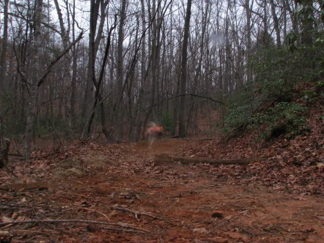
When I got home there was my dog looking sad so I did a fast turn around and headed right back out with him to the Green River Game lands once again for some more fun with the camera. By this time it was late in the day and threatening rain so we just headed down Long Ridge to Turkey Gut to Stairstep Falls to play with the camera once again. Duma was acting like a madman running all over the place and I couldn’t really get a shot I liked but it was still fun trying. Here is Duma looking more like a ghost than a dog:
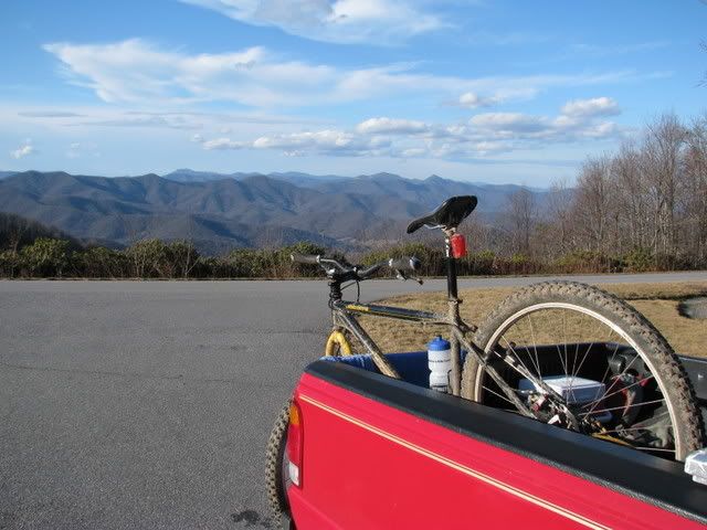
Even four day weekends eventually end and to bring closure to the long days spent in the woods I decided a shuttle run was in order. A quick call to the park service revealed that the Blue Ridge Parkway was open all the way to 276 so I decided to park at the Mills River Valley overlook and do a stretch of the Shut In. Here is my shuttle vehicle at the drop location:
Terri is a runner and we have been talking about the Shut In race some and have wanted to scout out the trail so what we did was drop my bike at the overlook and then drove back down to Beaver Gap Dam where we started hiking the trail. With temperatures in the 60’s and no sign of rain it couldn’t have been any better of a day to be out in the woods.
We hiked for a few hours and then I bombed down the parkway on my trusty steed for my first ever shuttle run. Climbing is overrated – from now on I’m driving to the top!


No comments:
Post a Comment