Sunday, January 26, 2020

Run Me Out

What do you do when it is in the 40's and raining on a Saturday in January?

You head to Pisgah and drive up high and then run even higher and with the parkway closed you get trails and roads that are usually full of people all to yourself. Try it sometime.

2020-01-19_10-02-16

2020-01-19_10-03-04

2020-01-19_10-03-17

Thursday, January 23, 2020

Plane Crash

Way back in 1983 things went really wrong and a plane crashed high on Browning Knob. They almost made it but almost isn't a word that applies to most plane crashes. I'd read about this site last year and have been eager to go there but the standard three-mile round trip route hardly sounded adventurous and seemed too easy so I'd been putting it off until I could do a longer and more proper route to this tragic site.

Starting from Pinnacle Park just outside of Sylva, Yuri and I headed up the West Fork trail and then over the top of Black Rock.

2020-01-15_09-58-26

From there we stayed on the ridge top and went through some very nice stretches of spruce-fir forest with nice rocky outcrops and even some interesting logging artifacts.

2020-01-15_09-59-14

The ridgeline would take us across three six thousand foot peaks. Yellowface Mountain, Waterrock Knob and Browning Knob. The trail to the plane crash had several groups headed to it but when the plane appeared there was nobody but us there and we had a few minutes to think about it all to ourselves.

2020-01-15_10-03-24

This is an interesting but quite somber site. You don't often get to see the remnants of a plane crash but it is nothing to take lightly. Two people died here. We took a look but didn't linger long.

2020-01-22_09-40-33

The plane had been our destination and from there we turned around and retraced our route back to Black Rock as we enjoyed the unseasonably warm day and raced the sunset. It was a great route coming in right at 13 miles with 5700' of climbing.

Sunday, January 5, 2020

Mountain Bridge Wilderness

I love the Mountain Bridge Wilderness in Upstate SC but rarely go there. The terrain is rugged and the trails are great but the trailheads are often crowded and full and the parks are full of regulations so I often just go somewhere I don't need to worry about any of those things but a few weeks ago I finally got around to checking out Raven Cliff Falls for the first time.

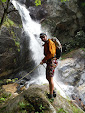
It is a short distance to the overlook on Raven Cliff Falls Trail where you can see the mighty waterfall looming in the distance. This waterfall would be perfect for rappelling but it is in SC so that won't be happening. 


20191221_125328

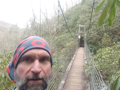
I turned around at the overlook and headed to Gum Gap trail and then eventually on to Natureland Trust Trail and the top of the waterfall I had just been admiring. There is a nice swinging bridge that takes you right over the top of the waterfall.


20191221_134221


2019-12-26_09-33-47

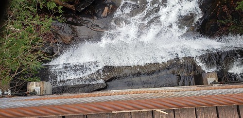
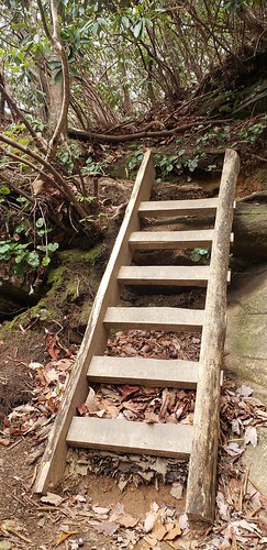
There is a sign on the bridge warning you that it will take 4-6 more hours from there and the next stretch of trail was a game of shoots and ladders as I worked my way down to the bottom of the waterfall.


2019-12-26_10-50-44


2019-12-26_10-51-03

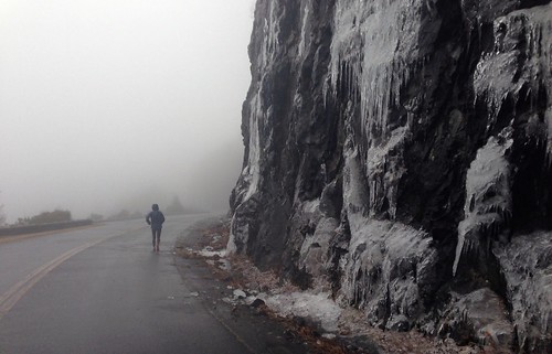
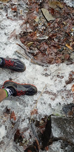
There was a big rocky cliff face with some spray coming off it that freezing into marble-sized balls as it fell to the ground which was a quite interesting phenomenon.

2019-12-26_10-51-26

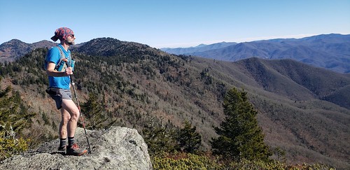
From that point, I was expecting Natureland Trust to get a little easier but it never did. Ceaser's Head came into view as I slowly worked my way up through the boulders to highway 276.

2019-12-26_10-52-50

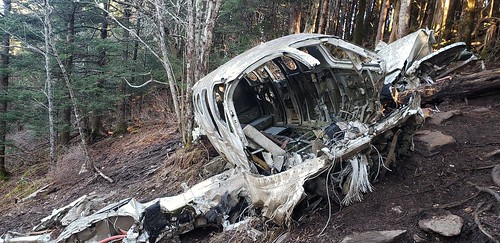
I'd gotten a late start and was starting to push the sunset but I crossed 276 and heading for Coldspring Branch to round out the half-marathon and complete the loop. Near the end, I was rewarded for my efforts with this tree.

2019-12-26_10-53-19